Soccer field map
El Camino Park
Palo Alto
Temporary closure: the City of Palo Alto reports that the soccer field and part of the adjacent parking lot are closed for turf replacement, with reopening anticipated in November 2026. Check the city notice under Venue information before visiting.
Main
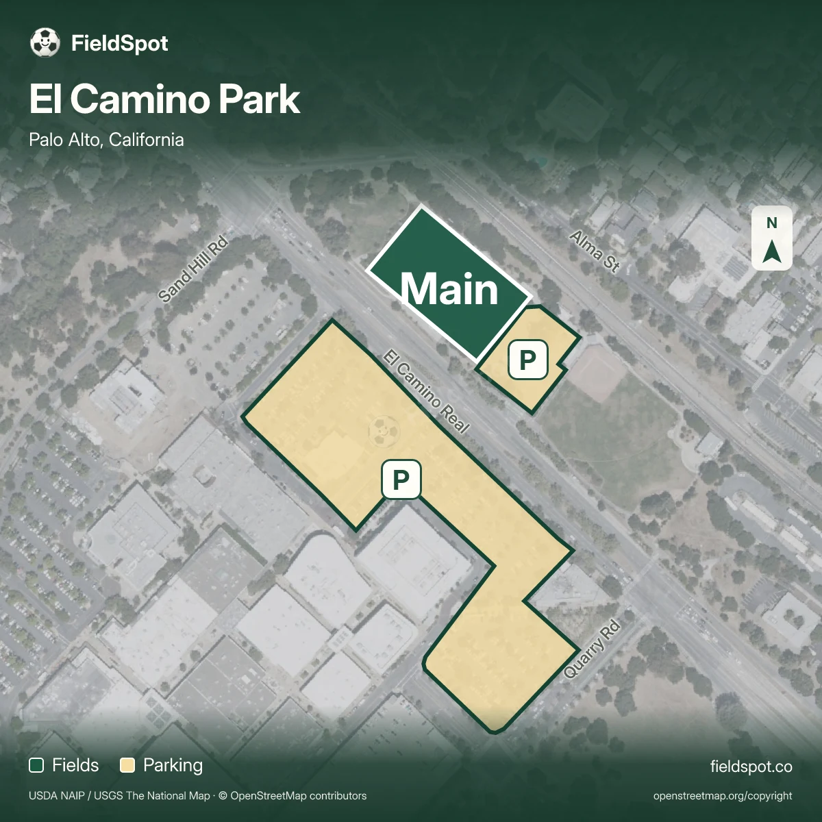
Main is mapped at El Camino Park in Palo Alto. Main Lot is the recommended lot.
 Open map image ↗
El Camino Park soccer field map
Palo Alto, California
Locate the main soccer field and mapped parking at El Camino Park, 155 El Camino Real in Palo Alto. The city currently reports a turf-replacement closure; check its official notice before planning a visit.
Parking and directions
As checked on October 21, 2026, the city says the soccer field and part of the adjacent parking lot are closed for turf replacement, with reopening anticipated in November 2026. Use the official city link below for the latest status. The map shows locations and does not confirm that a field or lot is open.
Field and parking questions
Which fields are shown at El Camino Park?
The map locates the main soccer field at El Camino Park. The City of Palo Alto currently reports that the soccer field is closed for turf replacement.
Where should I park at El Camino Park?
Mapped parking is shown for location context. The city says part of the adjacent lot is closed during construction; check its current notice before travelling.
Can I share the El Camino Park field map?
Yes. Use Share field map with your field selected to share a link that opens the same mapped field.
When is El Camino Park expected to reopen?
As checked on October 21, 2026, the city anticipates reopening in November 2026. This is an estimate; the official city notice is linked in Venue information.
Bring the details together for your team.
Make a game plan